


Good Walking and Clear Water in the Baird Mountains
A TRIP REPORT FROM THE BROOKS RANGE WITH LUC MEHL

LUC MEHL 〡 July 25th, 2022
In August of 2015, Sarah and I traveled to the villages of Noatak and Kivalina, northwestern Alaska, as part of the Skiku / NanaNordic volunteer program. These programs provide skis and coaches to village schools throughout Alaska. Skiku has been successful, in large part due to its consistency—returning to the same villages year after year. In that spirit, Sarah and I spent those autumn days taking over the PE classes and assisting the cross-country running coaches.

After our time at the Noatak school, our friend and Noatak teacher Timm Nelson guided us to the corner of the Baird Mountains accessible by the Noatak River. We spent a few days making a ~16-mile hike and packraft loop. It was a trip of contrasts: some of the absolute best (ridge) and worst (valley) hiking we’d ever experienced in Alaska.
Our time with Timm planted the seed for a return to the Baird Mountains. I suspected that, if we could avoid the low country (the tussocks), we’d find some of the best, sustained, off-trail hiking in Alaska.
In 2022, we made it back to the Bairds. We planned to be in the mountains for a few weeks, with a migrating basecamp that would allow us to hike and packraft short loops with lighter packs. We flew from Kotzebue to a gravel strip in the alpine to avoid the tussocks in the lowlands, and paddled the rivers out to Kotzebue for our exit. Sarah had a sore throat when we landed, which quickly developed into an energy-sapping illness, probably covid (though, she tested negative that morning). I geared up to do some day hiking on my own, but after watching a grizzly bear from camp, we decided to stick together. We spent a few days laying low, and started hiking when Sarah’s energy came back. Once Sarah had recovered, it was my turn to be sick!
We were fortunate to have planned a basecamp-style trip … it allowed us to lay low when we needed to, and we were still able to hike and float the two rivers that bound this isolated pod of the Brooks Range: the Omar and Agi (we didn’t paddle the Squirrel River, which flows south to Kiana).
The Omar River first caught my attention when browsing photos on Google Earth. A photo near a mining camp shows a pool of clear blue water bound by limestone rock outcrops and spruce trees. It is a gorgeous setting—an image that held on to real estate in my brain for several years.
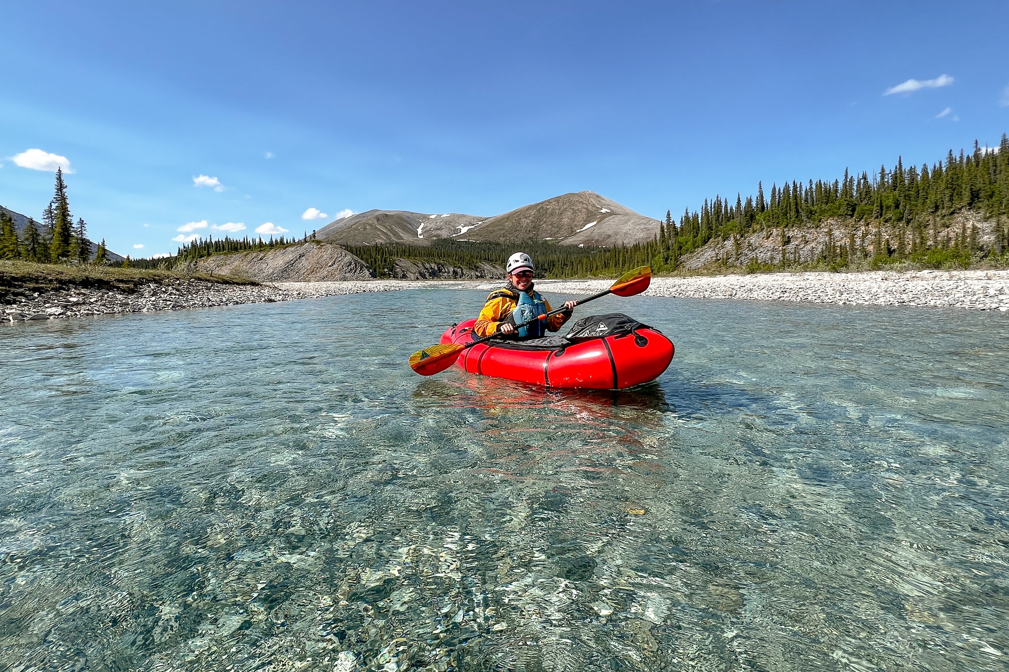
We paddled fifteen miles of the Omar, with barely enough water. The joke, while scraping our way down the river, was, “at least it’s not scary!” My impression is that this is typical of the Baird rivers — too unreliable to be a paddling destination. We ‘starfished’ (splayed) our way down much of the river and celebrated stretches that didn’t involve grounding out.
Sarah


The mountains are nearly entirely limestone, which erodes into cobbles and tiny suspended crystals but not much sand- or silt-sized particles. The suspended crystals scatter light on the green-blue end of the visible spectrum. The deeper the water, the darker the color.
After two comfortable days paddling the Omar, we hiked ridges and dry valleys to complete a loop back to our starting point. True to our expectations, this was some of the best walking we’ve experienced in Alaska.
After completing the Omar loop and taking another sick rest day, we packed to move the basecamp westward, toward our exit on the Agi River. We had planned a three-day hiking loop, but lost those days due to our illnesses. Hiking toward the Agi was about as good as it gets—caribou trails on rocky soils.


We reached the headwaters of the Agi in time to catch several days of low clouds and heavy rain. We had each read ~five books on our kindles during our sick days, so we traded kindles for new book selections. We both liked Greenwood, with The Shadow Land as a close second. One evening I sent an inReach message to our in-town contact, from the tent, and then set the device aside. Some time later, the inReach chirped to indicate an incoming message. I thought I heard something outside the tent react to the chirp, so I stuck my head out the door and spotted a very round and fuzzy grizzly bear running away from the tent. I don’t know how close the bear had been, but it was reassuring to see its motivation to make space.
The rain was actually welcome. We’d seen a little bit of the upper Agi during our flight, and concluded that it was too shallow to float. We anticipated needing to hike the first 30 river miles. But the rain brought in enough water so that we only hiked five miles before inflating our packrafts. The Agi was a wonderful float. The water was more green than the clear/blue of the Omar, but the benign canyon walls and good gradient made for a scenic, fast, and interesting float. We loved it.

The Agi doubles in volume after 30 river miles, and the canyon walls are replaced by forested or tundra slopes. We had a second fun animals-from-the-tent episode on the lower banks of the Agi. We woke up in the morning to loud clomping coming toward us. It is pretty typical for one of us to wake in the night thinking we heard something, but it is almost always the wind, the flapping tent, water, or nothing. Not this time!
We threw the door open, bear spray in hand, and watched as a moose cow and calf sprinted down the gravel bar toward our tent. Then they waded across the river. The cow (wading) herded the calf (swimming) to shore, and looked ready to use her muzzle to bump the calf up out of the water. Wide awake, we started packing and preparing for another day on the water. Later that day we were thrilled to see ~20 musk ox on the gravel bar.

After an uncomfortably windy afternoon (it put the open-water packraft fatalities into perspective), and skirting around a permafrost cutback, we spent a night at the confluence of the Noatak. We were met the next day by Kotzebue friends James Austin, Will, Hannah, and James’ sister for a boat ride to Kotzebue. It would be possible to paddle these last 30 miles to Kotzebue, but it wouldn’t be much fun, especially with the typical headwind.
Our trip ended up being about 35 hiking and 70 paddling miles. My overall impression of the Bairds is that they have some of the best hiking terrain in Alaska. The hiking opportunities, especially in the central and eastern regions, are unlimited.
But it would be hard to plan a paddling trip to the Bairds. We timed our trip to catch the end of the snow melt pulse (mid-June). There was still snow on the banks—but even so, we were late. Or early. I think you probably just have to catch the rain.
Thanks to James and Will for the ride, and Kris and Amy Rose for mid-day hospitality. We flew with Eric Sieh of Arctic Backcountry.

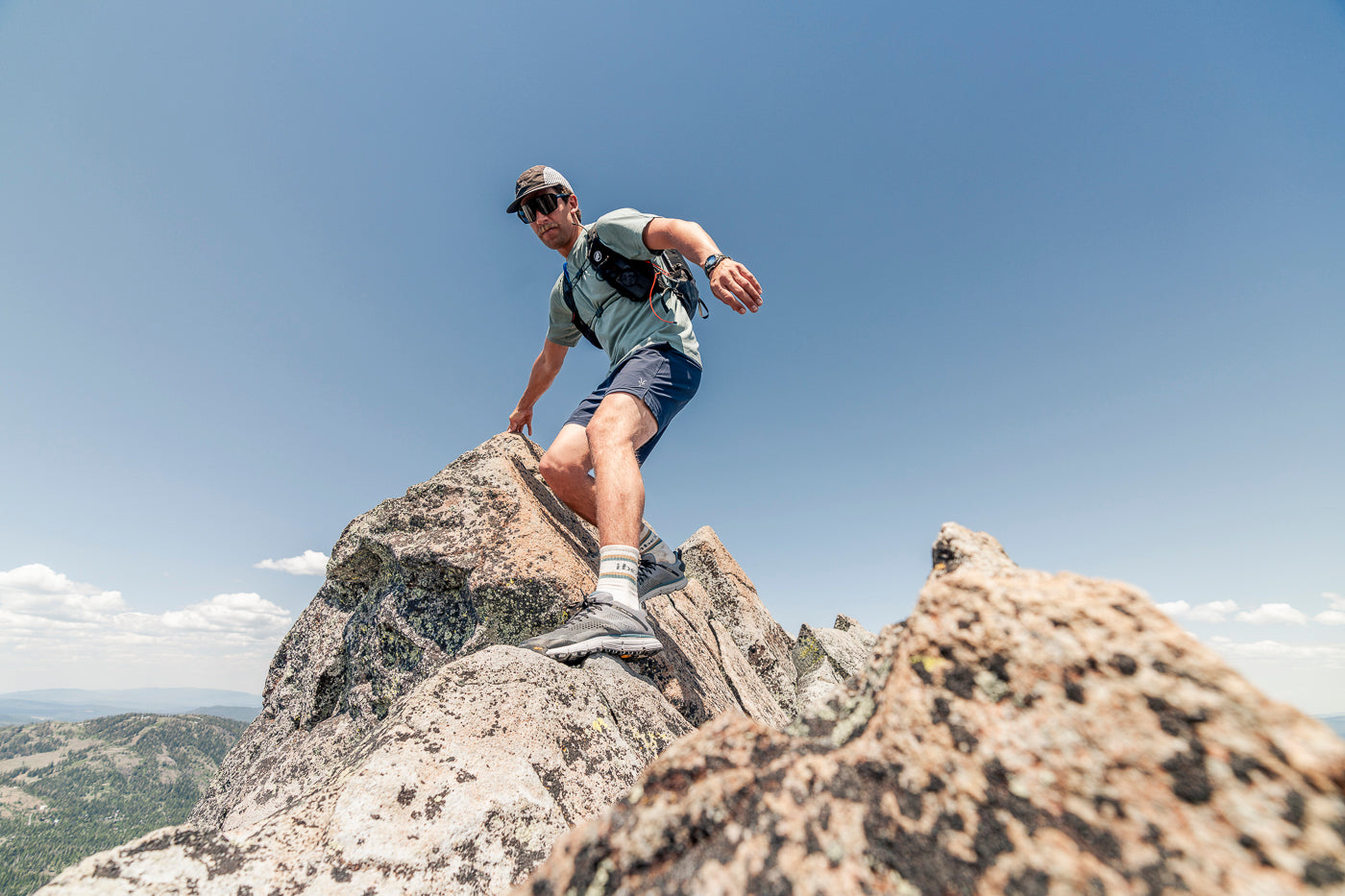
Luc Mehl is an adventurer and outdoor educator based in Anchorage, Alaska. Luc uses advanced trip-planning tools to create ambitious trips well off the beaten path. Luc has traveled over 10,000 miles of Alaska by boot, ski, boat, bike, and ice skate. His trip reports and educational resources can be found at thingstolucat.com
Luc's favorites

The packraft handbook
The Packraft Handbook is the definitive instructional resource for packrafting—everything you need to know to begin, improve, or assist others. Caring, curiosity, and intentional practice will help you anticipate what might go wrong and how to react when it does.

indie hoOdie
An all around favorite lightweight hoodie designed for active days made from 100% merino.

WOOLIES TECH BOTTOMS
A performance lightweight packrafting favorite for under your drysuit for those icy water swims.